This section of the Transportation Improvement Program (TIP) focuses on the State Transportation System and Major Projects located within Miami-Dade County. The projects listed include improvements to highways, transit, aviation, rail, seaport, freight, and bicycle/pedestrian modes over the next five fiscal years.
The FDOT, District Six section provides an overview of the following topics:
- The FDOT Five Year Work Program
- The Work Program Cycle
- Programs and Funding
- Strategic Intermodal System (SIS) Projects
- Other Major Corridor Improvements
- Intelligent Transportation System (ITS) Program
- Bicycle/Pedestrian Corridor Improvements
- Public Transportation Projects
The Florida Department of Transportation’s Five-Year Work Program
The FDOT District Six Work Program is a major component of the Miami-Dade Metropolitan Planning Organization’s (MPO) TIP. The Work Program, which is updated annually, is a project specific list of transportation activities and improvements that the FDOT will undertake during the next five-year period. It is developed by the District in cooperation with the Miami-Dade MPO, and is consistent with the 2040 Long Range Transportation Plan (LRTP), and MPO priorities. The projects must also meet the objectives of the 2060 Florida Transportation Plan (FTP). The first three years of the Adopted Work Program represent a commitment that local governments may rely on for planning purposes, and for the development of capital improvement elements of the local government comprehensive plans.
The Work Program Cycle
The Department coordinates development of the Work Program with the MPO TIP Committee process and input is received through public hearings. In the summer of 2015, FDOT began the new cycle to develop the “Tentative” Work Program for Fiscal Years (FY) 2017 – 2021. The final tentative program is sent to the Governor and the State Legislature for review in January 2016, and will become effective on July 1, 2016.
Programs and Funding
Program Descriptions
For budgeting purposes the FDOT’s Work Program comprises five departmental programs including; Product, Product Support, Operations and Maintenance, Administration and Other. An overview of each program is summarized below:
- Product – The FDOT’s Work Program Product consists of all transportation improvement projects for highways, bridges, transit, aviation, rail, seaport, freight, and bicycle/ pedestrian modes. It also includes the land cost of right-of-way acquisition, resurfacing improvements for preservation of the transportation system, and safety programs.
- Product Support – Product Support includes preparation of planning studies, project development and environmental studies, design plans, right-of-way support costs for managing acquisition activities, environmental mitigation as well as construction engineering and inspection of projects noted above under the heading – Product. It also includes management and program oversight for public transportation grants.
- Operations and Maintenance – Operations and Maintenance includes the activities necessary to maintain and operate the transportation infrastructure once it is constructed. This includes routine roadway and roadside maintenance, bridge inspection, traffic engineering and operations, toll collection, and enforcement of motor carrier compliance laws.
- Fixed Capital – Fixed capital comprises Work Program development, financial services and budget, information systems, legal, personnel, and contract administration functions. It also includes construction and rehabilitation of department buildings and facilities.
- Other – Other activities include debt service, State Infrastructure Bank (SIB) loan payback, maintenance of the FDOT’s mobile equipment and operation of the FDOT warehouse and supply system.
Funding Overview
The Department’s funds are allocated among seven Districts statewide. In Miami-Dade, the MPO in consultation with the Department, determines the best use of Miami-Dade’s share of funding. The Department’s resources are primarily from federal and state dedicated sources. The State Transportation Trust Fund and the Federal Highway Trust Fund receive revenue from specific tax sources for transportation purposes. Additional funding for Work Program projects comes from local and discretionary sources. By statute, the Department must develop a program that is balanced to cash and revenue forecasts.
FDOT District Six, Total Budget Breakdown Tentative Five Year Work Program
Fiscal Years 2017-2021
As shown in the Total Budget Breakdown, the majority of the Department’s $3.64 billion budget is applied to the product budget in the amount of $2.5 billion.
FDOT District Six, Product Budget Breakdown Tentative Five Year Work Program
Fiscal Years 2017 – 2021
The product budget includes money spent on construction, public transportation, right-of-way, and other product. As shown in the Product Budget Breakdown chart to the right, approximately $1.8 billion (72.2%) of the budget will go towards funding construction projects, which fall under four major construction categories: capacity improvement, safety, bridge, and resurfacing; approximately $425.8 million (17%) will go towards public transportation programs and services; approximately $227 million (9.1%) will go towards
the purchasing of right-of-way; and the remaining $43.7 million (1.7%) will be applied to other product, which consists of County Transportation Programs such as the County Incentive Grant Program and the Transportation Alternatives Program.
Strategic Intermodal System (SIS) Projects
Florida’s Strategic Intermodal System (SIS) is a transportation system that comprises facilities and services of statewide and regional significance. The SIS includes linkages that provide for smooth and efficient transfers between modes and major facilities. The SIS is intended to integrate all modes of transportation into a single intermodal transportation network. The SIS was established to efficiently serve the mobility needs of Florida’s citizens and businesses, as well as visitors, and to position Florida as a worldwide economic leader, with enhanced global competiveness.
The SIS network of high-priority transportation facilities includes commercial airports, spaceports, deepwater seaports, freight rail terminals, passenger rail, intercity bus terminals, rail corridors, waterways and highways. These facilities carry more than 99% of all commercial air passengers, virtually all waterborne freight tonnage, almost all rail freight, 89 % of all interregional rail/bus passengers, more than 70% of all truck traffic and 55% of total traffic on the State Transportation System. The following are major SIS improvement projects in Miami-Dade County:
I-75/SR 826/Palmetto Expressway Express Lanes
This project consists of the implementation of tolled express lanes along the SR 826/Palmetto Expressway from SR 968/Flagler Street to NW 154th Street and along I-75 from SR 826/Palmetto Expressway to NW 170th Street in Miami-Dade County. The project is approximately 13 miles in length and will provide continuity to the I-75 Express Lanes, which extends to I-595 in Broward County.
The project is part of the emerging South Florida Express Lanes network. It will improve mobility, relieve congestion, accommodate future growth and development in the region, enhance emergency evacuation, and improve connectivity with SR 826/Palmetto Expressway, I-75, SR 924/Gratigny Parkway, Florida’s Turnpike, I-595, and the SR 869/Sawgrass Expressway.
The total construction cost for the Miami-Dade design build project is $246 million. Construction began in February 2014 and is estimated to be complete by the Fall of 2017. For information about the construction schedule or related information, please call Public Information Specialist Marta Rodriguez at (305) 470-5349 or visit www.PalmettoExpressLanes.com.
SR 826/Palmetto Expressway Eastbound to SR 9A/I-95 Northbound Ramp Connection
The primary purpose of this project is to provide a direct ramp connection from eastbound SR 826/Palmetto Expressway to northbound I-95 (depicted as feature 1 in the graphic). The ramp connection, located within the Golden Glades Interchange, will lead to improved operations via a direct expressway-to-expressway connection between SR 826 and I-95, two of Miami-Dade’s major expressways.
Other key features of this project include:
- The relocation of the NW 12th Avenue on-ramp to I-95 northbound and southbound with an increase in ramp curvature to enhance safety.
- Provision of Texas U-Turns at NW 12th Avenue and NW 17th Avenue interchanges.
- Widening of the Turnpike connector to provide two lanes from the Turnpike southbound merging with the SR 836 eastbound to I-95 southbound traffic.
- Replacement of the SR 826 Connector Bridge and NW 167th Street westbound to I-95 Ramp Bridge to accommodate direct flyover connection ramp and SR 7/US 441 northbound lanes.
- Provision of signalized dual left turn lanes from SR 826 to northbound Turnpike.
- Relocation of Turnpike Connector to SR 7/US 441 Off-Ramp to increase distance between signals in order to improve operations along the Turnpike Connector.
- Widening of I-95 southbound from the interchange to NW 151st Street in order to accommodate the additional lane from the Turnpike Connector.
- The provision of dual northbound left turn lanes at NW 2nd Avenue and NW 167th Street intersection to improve intersection operations.
Approximately $118 million has been programmed for construction and construction support in FY 2019.
SR 997/Krome Avenue Corridor Improvements
SR 997/Krome Avenue is a major north-south SIS corridor that extends from US 1 in Florida City to US 27/SR 25/Okeechobee Road. The Krome Avenue corridor serves a mix of users ranging from commuters, trucks, and farm equipment within the agricultural area. This project will improve safety for all users along the corridor. The existing two-lane undivided roadway will be widened to a four-lane divided section with inside and outside shoulders. Upon completion, there will be two northbound lanes and two southbound lanes. This corridor has been broken down into several segments for design and construction with notable progress as follows:
- Mile Post 10.935 to South of Okeechobee Road/Mile Post 14.032 – This project is currently in the design phase. Construction and widening to 4 lanes is expected to begin March 2016.
- Mile Post 8.151 to Mile Post 10.935 – This project is currently in the design phase. Construction and widening to 4 lanes began on June 2015.
- Mile Post 5.122 to Mile Post 8.151 – This project is currently in the design phase. Construction and widening to 4 lanes began on July 2015.
- Mile Post 2.754 to Mile Post 5.122 – This project is currently in the design phase. Construction and widening to 4 lanes began on August 2015.
- North of SR 90/SW 8th Street to Mile Post 2.754 – Construction and widening to 4 lanes began on August 2015.
- SR 94/Kendall Drive to SR 90/SW 8th Street – Construction and widening to 4 lanes began on February 2015.
- SW 136th Street to SR 94/Kendall Drive. – Construction and widening to 4 lanes is expected to begin August 2016.
- SW 184 St to SW 136 St – This project is currently in the design phase. Construction and widening to 4 lanes is scheduled to begin September 2018.
- SW 232 St to SW 184 St – This project is currently in the design phase. Construction and widening to 4 lanes is scheduled to begin October 2018.
- SW 296 St to South of SW 232 St – This project is currently in the design phase. Construction and widening to 4 lanes is scheduled to begin August 2019.
- SW 312 St to SW 296 St – This project is currently in the design phase. Construction is scheduled to begin September 2019.
SR 826/836 Interchange Improvement
The 16-mile north/south Palmetto Expressway corridor was divided into 12 separate segments for construction. Eleven of the segments have been completed to date, with the last completed project being the Bird Road to Sunset reconstruction, completed in 2012.
The largest and final segment, the SR 826/836 Interchange reconstruction, began construction in November 2009 and is expected to be completed in June 2016. All 45 bridges, including the four segmental bridges have been constructed and opened to traffic. This project is expected to enhance safety, add capacity and increase the efficiency for motorists using the Interchange.
NW 25th Street Reconstruction and Viaduct Construction
The NW 25th Street reconstruction and viaduct construction is divided into two separate projects. The first project, from the SR 826/Palmetto Expressway east to 67th Avenue, is complete. The second project, from the SR 826/Palmetto Expressway west to 89th Court, began construction in June 2012 and is scheduled to be completed in June 2016. The overall project includes: 1) the widening and reconstructing of NW 25th Street; and 2) building a viaduct (an elevated bridge) to separate truck traffic bound for the airport from NW 25th Street. With the completion of the second project, the viaduct is expected to alleviate heavy truck volumes, and improve traffic flow on NW 25th Street; and improve the movement of cargo to and from the west-side cargo facilities at Miami International Airport (MIA).
SR 25/US 27/Okeechobee Road Improvements
A Project Development and Environment (PD&E) study is being conducted for SR 25/US 27/Okeechobee Road from SR 997/Krome Avenue to NW 79th Avenue in order to identify feasible improvements along the corridor. Major improvements are needed to address operational, safety and capacity deficiencies along the corridor at the access points. With these improvements, it is envisioned that, corridor operations and level of service will be improved, throughput along the corridor will be increased and efficient transfers between modes will be provided which is critical to Florida’s economy and sustained growth. A public hearing on the PD&E study is scheduled for March 2016. The PD&E project is expected to be completed in July 2016.
Based on findings from the PD&E, five segments have moved forward into the Design Phase. The following corridor improvements on SR 25/Okeechobee Road include:
- West of Krome Avenue to East of NW 117th Avenue- Widening, capacity improvements, milling and resurfacing, as well as including a frontage road on the north side of the said limits.
- East of NW 117th Avenue to East of NW 107th Avenue- Full reconstruction to provide concrete pavement, correct geometric and operational deficiencies, and widening of the existing roadway and bridges for added capacity.
- East of NW 107th Avenue to East of NW 116th Way- – Full reconstruction to provide concrete and rigid pavement, widening of bridges at NW 121st Avenue and NW 116th Way over Miami (C-6) Canal, design of two braided ramps under SR 25/Okeechobee Road to connect with NW South River Drive and Frontage Road.
- East of NW 116th Way to East of NW 87th Avenue- Full reconstruction to provide rigid pavement, grade separation of bridges over 87th Avenue, design of left turn lanes flyover bridges from Southbound NW 87th Avenue to Eastbound Okeechobee Road and from Northbound NW 87th Avenue to Westbound Okeechobee Road, a construction of a new bridge at NW 106 Street over the Miami (C-6) Canal, and the realignment of NW 103rd Street and the frontage road within the project limits.
- East of NW 87th Avenue to NW 79th Avenue- – Full reconstruction to provide road using rigid pavement, widening of SR 25/Okeechobee Road to four lanes on both approaches, modify the intersection of NW 95th Street and Frontage Road, widen NW 79th Avenue bridge of Miami (C-6) Canal, and provide new access from Frontage Road to Westbound Okeechobee Road.
I-395 Corridor Improvements
This project involves the rebuilding of the Interstate 395 (I-395) corridor from its terminus at the west of the I-95/Midtown Interchange (I-95/State Road 836/I-395) to its corridor terminus at the West Channel Bridges of US 41/MacArthur Causeway, approximately 1.4 miles. I-395 is a major east-west connector serving Miami Beach and the Port of Miami. Proposed improvements include: (1) Building new elevated ramps (one eastbound and one westbound) that will provide direct linkage between I-95 and I-395. (2) Improving roadway design including updating the alignment and upgrading the roadway surface. (3) Creating an aesthetic signature bridge. (4) Building vertically higher structures that will improve the visual quality of the bridge. The construction cost is estimated between $500 million and $600 million.
Golden Glades Intermodal Center
Located in northern Miami-Dade County, adjacent to city of Miami Gardens, North Miami Beach, North Miami and the Golden Glades Community. The center will consolidate the existing bus transit services at Golden Glades into a single facility adjacent to the Tri-Rail Station. The new multi-bay bus terminal facility will include upgraded sidewalks, walkways, platforms, bus bays and all improvements related to transit operations, including internal roads, drainage, lighting systems, fencing, internal directional and traffic control signage. The center will feature a multi-story parking garage with 920 spaces and surface parking lots with 768 spaces, equaling to a total of 1,688 parking spaces. Additionally, the center will provide 27 spaces for scooters and motorcycles. Other amenities will include bicycle parking and lockers. The complex will also feature a 4,500 square feet (sf) transit hub, 10,450 sf of retail space, and a 945 sf break lounge for bus drivers.
SR 826/Palmetto Expressway from I-75 to NW 17th Avenue
Based on the results of the alternatives analysis as well as input received from the public for the SR 826/Palmetto Expressway from I-75 to NW 17th Avenue project, FDOT identified a Recommended Alternative for the mainline of the east-west corridor of the Palmetto Expressway and for each interchange along the corridor including the Golden Glades Interchange (GGI).
Recommended Alternative improvements includes:
- Reconstruction and widening of the SR 826/Palmetto Expressway mainline to include three 12-foot general purpose lanes in each direction. (See Figure 1-1).
- A one 12-foot auxiliary lane would be added in each direction between interchanges. This is expected to improve traffic safety and operations.
- Two express lanes in each direction. The express lanes would be separated from the general purpose lanes by a 4-foot buffer. At the western and eastern project limits, the express lanes transition from two lanes to one with a connection to the planned SR 826 North-South Express Lane System and a direct connect ramp to I-95 Express at the Golden Glades Interchange.
- Express lane connections. The recommended alternative for the express lanes access points includes one ingress and two egress points in the NB/EB direction and two ingress and one egress points in the WB/SB direction. Access to and from the express lanes would typically be via slip ramps to/from the general purpose lanes. Direct connect ramps will be provided at the GGI (Se e Figure 1-2).
- Several existing interchanges are proposed to be modified including the Golden Glades Interchange. In addition, interchange modifications are proposed for NW 154th Street, NW 67th Avenue, NW 57th Avenue, NW 47th Avenue, NW 37th Avenue, NW 27th Avenue, NW 17th Avenue, and NW 12th Avenue. With the exception of NW 154th Street, all SR 826/Palmetto Expressway overpass bridges will be replaced and the SR 826/Palmetto Expressway mainline will be raised to satisfy current FHWA standards fo r vertical clearance over cross streets.
- The project is expected to include a new storm water drainage system to satisfy South Florida Water Management District water quantity and quality requirements.
Resurfacing Projects
The following are major resurfacing projects in Miami-Dade County:
SR 9A/I-95 Pavement Reconstruction
The I-95 Pavement Reconstruction project will reconstruct 3.04 miles of I-95 mainline Concrete Pavement from just north of NW 29th Street to just north of NW 79th Street. The pavement for ramps connecting I-95 to local streets and other SIS corridors will be improved. The project also includes traffic railing improvements to four bridges, approach slab replacement for 22 bridges, drainage system repairs and ITS improvements. Construction is scheduled to begin by Summer 2017 and be completed in late 2019.
This I-95 Pavement Reconstruction project will renovate and modernize the pavement structure in the vital I-95 SIS corridor and help capitalize on the opportunities afforded by the opening of the Port of Miami Tunnel to increase the safety and efficiency of freight utilization of the corridor while also improving the service life of the impacted roadway infrastructure.
Below is a sample of resurfacing projects included in the 5-year Work Program.
| Roadway | Project Area |
| SR 925/NW 3rd Court & NW 3rd Avenue | From NW 1st Street to NW 8th Street |
| SR 976/SW 40th Street | From East of SW 117th Avenue to East of SW 87th |
| SR 5/US-1/South Dixie Highway | From Riviera Drive to SR 9A/I-95 |
| SR 826/Palmetto Expressway | From West of NW 67th Avenue to West of NW 57th Avenue |
Other Major Corridor Improvements
The following are major corridor improvement projects in Miami-Dade County:
SR 823/NW 57th Avenue/Red Road Corridor Improvements
This project includes reconstruction of the existing roadway and widening to six lanes with a raised median. It also includes milling and resurfacing the existing six lane divided facility from West 53rd Street to West 84th Street. The retaining wall along the Red Road canal will be improved. The work also includes improved drainage, new sidewalks along the east side, new signalization, new lighting, and landscaping. The project is expected to enhance safety, add capacity, and increase efficiency for motorists using the corridor. All segments of this project are fully funded in the 5-year Work Program. Construction of improvements to the following segments have been completed:
- Okeechobee Road to West 23rd Street
- West 23rd Street to West 46th Street
- West 46th Street to West 53rd Street
The corridor improvements along the segments of West 53rd Street to West 46th Street and West 65th Street to West 84th Street have been progressing with an anticipated completion date of June 2017.
SR 847/NW 47th Avenue from SR 860/NW 183rd Street to Premier Parkway (Broward)
The 2.3 mile segment of SR 847/NW 47th Avenue from north of SR 860/NW 183rd Street/Miami Gardens Drive (Miami-Dade County) to Premier Parkway (Broward County). The preferred alternative from the PD&E phase will reconstruct the existing two-lane rural roadway to provide a four-lane divided urban roadway in order to accommodate projected traffic growth in the area. Design phase has begun and is anticipated to be completed in March 2017. Construction is anticipated to begin in December 2017.
SR 968/SW 1st Street at Miami River Bridge #870660
The existing SW 1st Street bascule bridge is a low‐level bascule (movable) bridge spanning the Miami River and carrying the eastbound lanes of a one‐way pair facility that comprises Flagler Street (westbound lanes) and SW 1st Street. The purpose of the project is to replace the existing bascule bridge. The PD&E Study for this project was completed and Location Design Concept Acceptance was granted in December 2013. The project is currently in the Design phase. The construction is anticipated to commence in August 2018.
Below is a selection of other major improvements included in the 5-year Work Program:
| Roadway | Project Type | Project Area |
| SW 312th Street/Campbell Drive | Flexible Pavement Reconstruction | From SR 997/Krome Avenue to SR 5/US-1 |
| SW 320th Street | Add Turn Lanes | From SW 187th Avenue to Flagler Avenue |
| NW 87th Avenue | New Road Construction | From NW 74th Street to NW 103rd Street |
| SR 94/Kendall Drive | Intersection Improvement | From SW 77th Avenue to SR 5/US-1 |
| SR 953/LeJeune Road | Intersection Improvement | From SW 2nd Street to NW 11th Street |
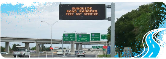
Intelligent Transportation System (ITS) Program
FDOT’s District Six Intelligent Transportation Systems (ITS) Program uses advanced technologies and operational strategies to manage the state’s highway system along Miami-Dade and Monroe Counties. The Program works to enhance the efficiency of our existing highway system by managing interoperable traffic services that are helping reduce traffic congestion and promote safety.
Traffic operators housed at the District Six SunGuide® Transportation Management Center (TMC) monitor the highways to manage traffic flow, clear incidents and keep drivers informed of roadway conditions. These activities allow the Program to provide the traffic management, incident management and traveler information services to the motoring public drivers 24 hours a day, seven days a week. The combination of these initiatives have proven ITS is a viable and cost-effective alternative to traditional widening projects. The latest annual report shows the Program reduced travel delays by 45% since 2005 and saved drivers approximately $2.6 billion dollars in travel delay-related costs. It also achieved its highest return on investment to date, with a benefits to cost ratio of $53.15 for every $1 invested in ITS. As a result, FDOT District Six remains committed to advancing ITS strategies in our community to benefits all drivers.
Bicycle/Pedestrian Corridor Improvements
The bicycle/pedestrian network is a component of the overall transportation system. The Department evaluates bicycle & pedestrian improvements in conjunction with all capacity and resurfacing projects. Bicycle & pedestrian projects are also implemented by local agencies, who oversee construction and management. In addition, some projects are funded through the federally funded Transportation Alternatives Program (TAP).
Safe Routes to School (SRTS) projects are another category of bicycle & pedestrian improvements focused on school zones, and are implemented by Miami-Dade County. The budgeted costs for TAP and SRTS projects in the FY 2017 – 2021 Work Program, are $22.9 million and $7.9 million dollars respectively.
Below is a snapshot of bicycle/pedestrian projects included in the FY 2017 – 2021 Work Program.
| Project Segment | Project Type | Project Area |
| City of Miami | Bike Path/Trail | Biscayne Green Trail along Biscayne Boulevard in Downtown |
| City of Hialeah | Bike Lane/Sidewalk | West 4th Avenue Frontage Sidewalk and Guardrail |
| City of Aventura | Pedestrian/Safety Improvements | Country Club Drive Pedestrian Safety Improvements |
| Safe Routes to School Infrastructure | Pedestrian Safety/Improvements | Lakeview, Arch creek & North Miami Middle, Eneida Massas Hartner & Jose de Diego Middle, Edison Park K-8 Center, Comstock, Lorah Park, Gratigny Elementary, Hibiscus, Sweetwater Elementary, Crestview, Key Biscayne K-8 Center, Howard Drive, Coral Reef, Dr. Henry E. Perrine Academy of the Arts, Linda Lentin K-8 Center |
| Town of Miami Lakes | Bike Lane/Sidewalk | Multi-Purpose Greenway/Sidewalk Network Improvements |
| City of North Miami Beach | Bike Path/Trail | NE 183rd Street from NE 11th Avenue to NE 19th Avenue |
| City of Miami Springs | Bike Lane/Sidewalk | Providing Access to the Curtiss Mansion as Trail Head |
| City of Miami Beach | Bike Path/Trail | North Beach Corridor- Various Bike Path Links, ADA Access, and Sidewalks |
Complete Streets Projects
The Florida Department of Transportation’s (FDOT) Complete Streets Policy, adopted in September 2014, promotes safety, quality of life, and economic development in Florida. It states that FDOT will routinely plan, design, construct, reconstruct and operate a context-sensitive transportation network that works for all modes of travel.
FDOT developed this Complete Streets Implementation Plan in partnership with the national not-for-profit organization Smart Growth America to guide the Department’s efforts to implement the Complete Streets Policy moving forward. The recommendations in this plan, summarized below, address the findings from a series of interactive workshops conducted for FDOT, District Six – State Transportation System and Major Projects FDOT’s Complete Streets Implementation Team in the spring and summer of 2015. This plan outlines a five-part implementation framework and process for integrating a Complete Streets approach into FDOT’s practices to ensure that future transportation decisions and investments address the needs of all users of the transportation network and respond to community goals and context. This plan also proposes a two-year schedule and process for Complete Streets Implementation, concluding in December 2017. The implementation framework in this plan includes: (1) Revising guidance, standards, manuals, policies, and other documents; (2) updating decision-making processes; (3) modifying approaches for measuring performance; (4) managing internaland external communication and collaboration during implementation; (5) providing ongoing education and training. The following are complete street projects from the Work Program:
SR 907/Alton Road from 43 Street to east of Allison Road
This project is currently in the Design phase and entails a full roadway reconstruction of Alton Road from 43rd Street to east of Allison Road. The project will improve the on-street parking and will add shared bicycle lane pavement markings. Pedestrian ramps and sidewalks will also be upgraded to current standards. There will be roadway drainage, signalization and lighting improvements, signing and pavement markings and a new landscape and irrigation design. This project will enhance safety and drainage throughout the corridor. The project is anticipated to begin construction in April 2020 and will cost approximately $24 million dollars.
Below is a selection of other complete streets projects included in the 5-year Work Program.
| Project Segment | Project Type | Project Area |
| SR 968/W. Flagler Street | Flexible Pavement Reconstruction | From West of SR 9/27th Avenue to West of 2nd Avenue |
| SR 968/SW 1st Street | Flexible Pavement Reconstruction | From West Flagler Street to East of 17th Avenue |
| SR 5/Biscayne Boulevard | Resurfacing | From NE 151st Street to NE 196th Street |
| SR 7/US-441/NW 7th Avenue | Resurfacing | From North of NW 79th Street to South of Biscayne River Canal |
Public Transportation Projects
Travel options are critical in an area such as Miami-Dade County. The Department works with the Miami-Dade MPO, Miami-Dade Transit (MDT), Miami-Dade Aviation, Port of Miami, and the South Florida Regional Transportation Authority (SFRTA) to implement multiple projects. The following are public transportation projects from the Work Program:
State Transit Block Grant to MDT for operating costs
This grant provides operating assistance for MDT’s Fixed Route Bus Service. The Metrobus fixed route bus service is run by MDT and operates seven days a week, 24 hours per day. A total of 93 routes comprise MDT’s regular bus service structure which are served by a total fleet of 823 buses and two contracted routes with seven buses. Metrobus includes local, feeder, circulator, limited stop, express, and Bus Rapid Transit (BRT) Arterial Busway services. The FDOT provides 50% State Participation Rate for this program.
NW 27 Avenue Premium Transit Corridor
A PD&E study is being conducted to evaluate the implementation of a premium transit service (BRT, Light Rail Transit, and other appropriate transit technologies) along NW 27th Avenue from NW 215th Street (Countyline Road) to approximately NW 38th Street and from the Miami Intermodal Center (at Miami International Airport) to NW 27th Avenue via SR 112 Expressway. The study will focus on NW 27th Avenue for providing the primary premium transit running way via exclusive transit lanes but will also include other roadways and expressways for accommodating potential branched transit routes. The study will consider public and private station/stop facilities, new or upgraded park-and-ride locations, and transit terminals.
Flagler Street Premium Transit Corridor
A PD&E study is being conducted to assess the implementation of a premium transit service (BRT, Light Rail Transit, and other appropriate transit technologies) along Flagler Street between Biscayne Boulevard near the proposed Downtown Miami Intermodal Terminal (at Government Center), along SW 8 Street from the proposed Tamiami Station park-and-ride at NW 147th Avenue to NW 107th Avenue by Florida International University (FIU), and along NW 107th Avenue between SW 8th Street and Flagler Street. The study will focus on the Flagler Street as well as SW 8th Street and SW 107th Avenue for providing the primary premium transit running way via exclusive arterial transit lanes but will also include other roadways and expressways for accommodating potential branched transit routes. The study will consider public and private station/stop facilities, new or upgraded park-and-ride locations, and transit terminals.
Kendall Drive Premium Transit Corridor
A PD&E study is being conducted to evaluate implementation of a premium transit service (BRT, Light Rail Transit, and other appropriate transit technologies) primarily along SR 94/SW 88th Street/Kendall Drive between Dadeland North Metrorail Station and SR 997/Krome Avenue, along SR 874 and SR 878 from Kendall Drive to the Dadeland North Metrorail Station, and potentially FDOT, District Six – State Transportation System and Major Projects north along the Homestead Extension Florida’s Turnpike from Kendall Drive to FIU (at the proposed Panther Station) and/or to the proposed Dolphin Station (at SR-836). Kendall Drive will serve as the primary premium transit running way via exclusive arterial transit lines but will also include other roadways and expressways connecting to Kendall Drive for accommodating branched transit routes. The study will also include public on-street transit stations located along various running ways as well as potential park and ride and/or transit terminal locations.
A sampling of other public transportation projects from the Work Program includes:
Rail Aviation
- Passenger and Freight Rail Safety Projects
- Railroad Crossing Surface Rehabilitation Projects
- Miami Dade County Quiet Zone around Florida East Coast Railroad
Seaport
- Improvements to Cruise Terminals B,C,D,E,F,G,H, and J
Aviation
- MIA Concourse E Satellite Improvements
- MIA Concourse E Satellite APM
- MIA A380 Gates D1 and D2
- MIA Runway Rehabilitation 12-30/TWY P-Q-R
- Opa-Locka Airport (OPF) Rehabilitation of Flexible Pavement
Freight Overview
FDOT District Six is home to many diverse communities with unique transportation needs, highlighted with some of the state’s leading freight facilities and international trade gateways, including Miami International Airport and PortMiami. Significant investments have been made to compete for new cargo opportunities stemming from the expansion of the Panama Canal, increased use of the Suez Canal, and growing North/South trade. These investments in freight mobility both internationally and in Miami will generate demand for new capacity of regional warehouses, distribution centers, cold treatment facilities, and foreign trade zones, and truck parking facilities.
In response, it is critical that District Six and industrial based communities identify and invest in infrastructure improvements to position themselves for economic development and growth in cargo. Key developments and tools should be incorporated such as ITS/technologies, truck parking needs, economic impact analyses, innovative funding programs, and land use and redevelopment opportunities – helping market these industrial based communities as competitive global logistics service centers.
SR-969/NW 72nd Avenue from NW 25th Street to NW 74th Street
NW 72nd Avenue is a critical truck route that includes several important nodes that connect to other truck routes. The segment is located on the West perimeter of Miami International Airport (MIA) and in close proximity to MIA’s Air Cargo Facility and other freight assets, such as the NW 25th Street Viaduct, SR 836, SR 826, SR 934, US 27, a robust warehousing district, and the South Florida Logistics Center.
Several freight need improvements identified in the 2014 Miami-Dade Freight Plan Update and included in the Miami-Dade 2040 Long Range Transportation Plan were successfully incorporated into the Resurfacing, Restoration and Rehabilitation (RRR) for the NW 72nd Avenue corridor. These freight needs incorporated into the production cycle included improvements to turning radii, left-turn/right-turn storage, signal timing, and the reduction of the high number of access points on side streets. Incorporating the freight improvements was accomplished through close coordination and collaboration with the Miami-Dade Metropolitan Planning Organization (MPO) and Consulting Design Firms as well as several divisions within FDOT District Six, including Intermodal Systems Development, Project Development/Scoping, Consultant Management and Work Program. Incorporating these improvements had no impact on the production schedule and required only an additional $100,000 in construction costs to achieve.
These incorporated improvements are directly tied to the following core Florida Freight Policy Objectives outlined in the Freight Mobility and Trade Plan (FMTP):
- No. 2 – Increase Operational Efficiency of Goods Movement
- No. 3 – Minimize Costs in the Supply Chain
- No. 5 – Raise Awareness and Support for Freight Movement Investments
- No. 7 – Transform the FDOT’s Organizational Culture to Include Consideration of Supply Chain and Freight Movement Issues
MAP – Resurfacing, Restoration and Rehabilitation (RRR) Improvements
MAP – PD&E, Design and Row Projects
MAP – Bicycle/Pedestrian, Drainage, Bridge and Landscaping Improvement Projects
MAP – Capacity, Interchange, Intersection, Safety and Traffic Operations
How do I get to full project costs and other project details?
Projects on the Strategic Intermodal System (SIS)
The normal project production sequence is to have a Project Development and Environment (PD&E) phase, a Design (PE) phase, a Right of Way (ROW) phase and a Construction (CST) phase. Some projects may not have a ROW phase, if land is not needed to complete the project. Costs on the TIP pages for projects on the SIS will have historical costs, five years of the current TIP and five years beyond the current TIP, which may or may not be the total project cost. If there is no CST phase on the TIP page, then the entry will probably not be reflective of the total project cost. For some projects, such as resurfacing, safety or operational projects, there may not be a total cost provided but rather additional details on that program.
The SIS is a network of high priority transportation facilities which includes the state’s largest and most significant commercial service airports, spaceport, deepwater seaports, freight rail terminals, passenger rail and intercity bus terminals, rail corridors, waterways and highways. All projects on the SIS will have a SIS identifier on the TIP page (See example TIP page below).
For costs beyond the five year window, access to the Long Range Transportation Plan (LRTP) is provided. The link to the LRTP is http://www.miamidade2040lrtp.com/wp-content/uploads/2040_LRTP_Plan.pdf. The LRTP reference on the TIP page provides information necessary to locate the full project costs and/or additional details regarding the project in the LRTP (see example below). If there reference in the TIP, full project costs are provided in the TIP.


Non-Strategic Intermodal System (SIS) Projects
The normal project production sequence is to have a Project Development and Environment (PD&E) phase, a Design (PE) phase, a Right of Way (ROW) phase and a Construction (CST) phase. Some projects may not have a ROW phase, if land is not needed to complete the project. Costs on the TIP pages for projects not on the SIS will have historical costs and five years of the current TIP, which may or may not be the total project cost. If there is no CST phase on the TIP page, then the entry will probably not be reflective of the total project cost. For some projects, such as resurfacing, safety or operational projects, there may not be a total cost provided but rather additional details on that program.
Total project cost and other project details will be accessible in the TIP for all non-SIS projects in the TIP. Projects not on the SIS will have a Non-SIS identifier on the TIP page (See example TIP page below).

For costs beyond the five year window, access to the Long Range Transportation Plan (LRTP) is provided. The link to the LRTP is http://www.miamidade2040lrtp.com/wp-content/uploads/2040_LRTP_Plan.pdf. The LRTP reference on the TIP page provides information necessary to locate the full project costs and/or additional details regarding the project in the LRTP. If there is no LRTP reference in the TIP, full project costs are provided in the TIP.